New Zealand adventures Part 4 ~ hiking at Mount Cook 新西蘭旅遊篇之一 ~ 庫克山遠足
Mount Cook is New Zealand’s tallest mountain, is located on the south island and is over 3700m above sea level. When I was flying to Queenstown from Auckland on the last leg of my epic 42 hour journey, I actually flew above Mount Cook. Isn’t this view absolutely amazing?
庫克山是紐西蘭最高的山,在紐西蘭南島,有超過3700米高。我之前飛了42小時出發到紐西蘭的時候,最後一程飛機就是飛過庫克山的上空。你看多壯觀?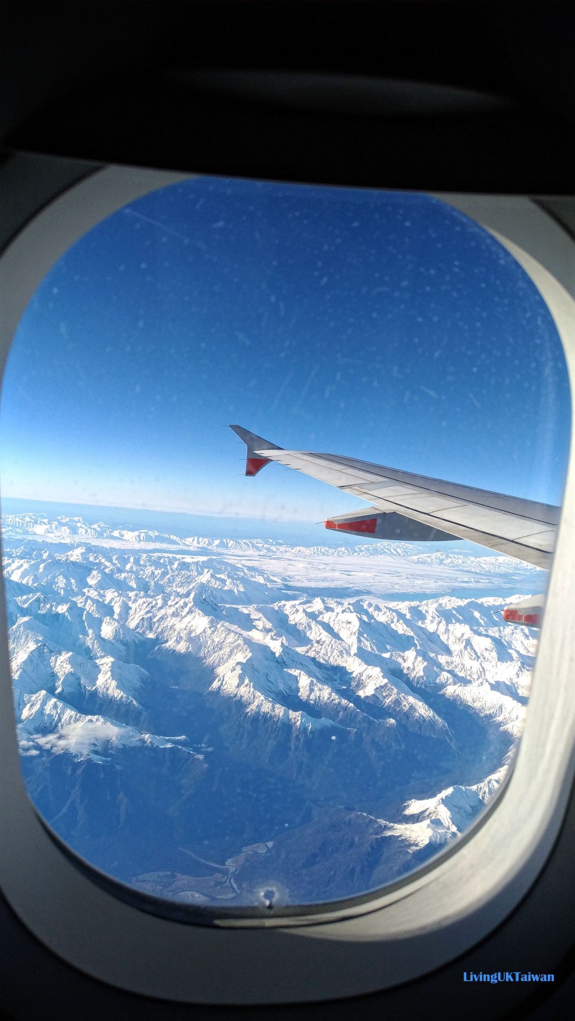
There are 23 peaks in the Mount Cook area, and various hiking routes of different lengths and difficulty, so no matter which route you take you are always guaranteed a fascinating view along the way. This was the view of the area as we were driving along State highway 80 towards Mount Cook.
庫克山區一共有23座山峰,還有多條不同難度及距離的步道可以走,無論你選擇那一條路,沿途風景都美不勝收。我們在80號公路上駕駛去庫克山區時,已看到整個山區的美景,還未到山區都已經讓人心矌神宜。
When we arrived, we parked our car at the Mount Cook village car park, and went to check at the information centre on the snow conditions. The conditions around the area can be quite unstable, so it is always a good idea to check with them before you start your walk. Upon their suggestion, we decided to do the 3km hike towards Kea Point. This is classified as an easy route and takes around 2 hours return. Of course this is just the walking time, but on a winter’s day it is more difficult to walk on the snow and then you have to factor in time to soak in the amazing scenery and photo stops, so it took us a bit longer.
我們到達後把車停在庫克山村的停車場,然後到遊客中心訊問當天天氣及步道情況。因為山區天氣變化可能很快,所以為了安全最好還是先確定一下比較好。職員向我們提意一條3km長往 Kea Point 的步道,屬容易程度,來回只要兩小時。當然這只是平常走路的時間,還未計算中途要拍照,再加上冬天在雪地上走路又要多花點時間,所以結果我們當然不只走了兩個小時。
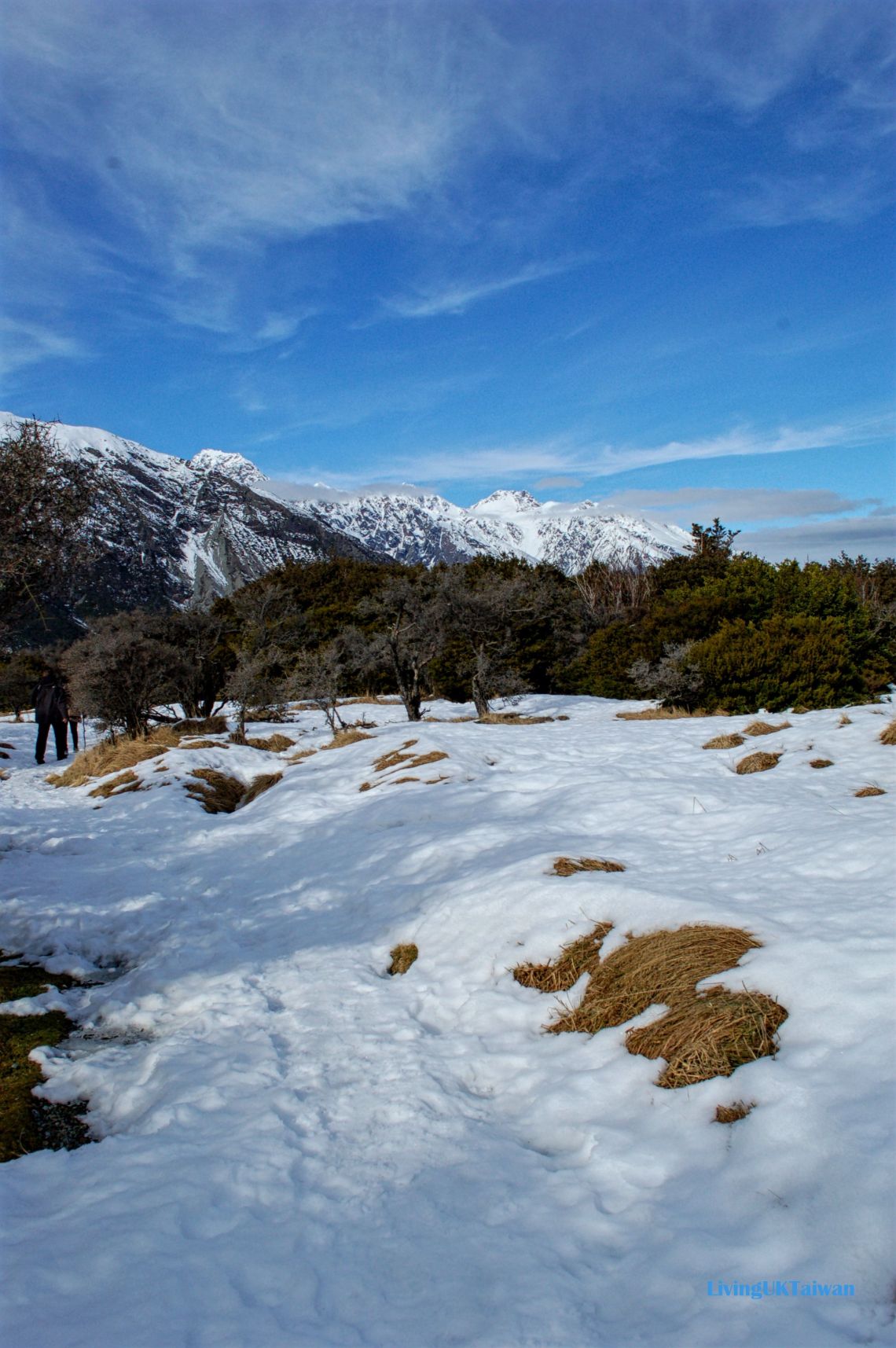
The walk started off along a wooden path so it wasn’t too difficult, but gradually the path was covered by the heavy snow from the past few days, so we had to carefully follow people’s footsteps to make sure we were on the right path.
開始時,我們沿著地上的木版步道走得蠻輕鬆,但漸漸木版步道已被前幾天的大雪蓋過,我們要小心翼翼跟著之前行人的腳步走,確保我們沒迷路。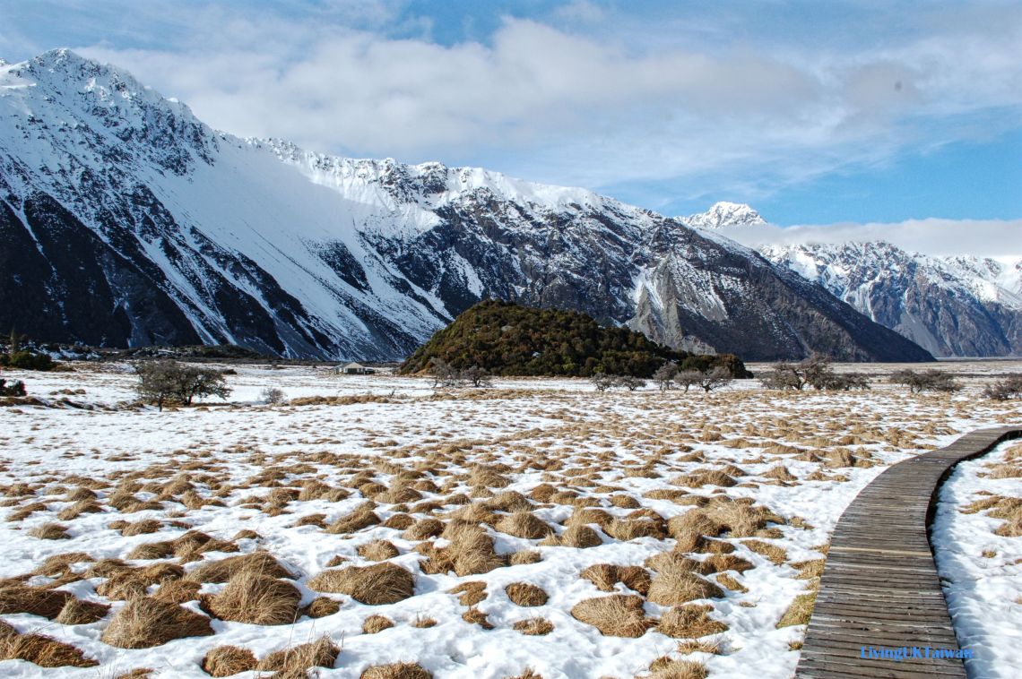

Seeing this sign ensured we were heading towards the right direction.
看到這個指示就安心了。
Eventually about 1.5 hours later we arrived at our desitnation Kea Point. Ahead of us was La Perouse, Mount Footstool, and Mount Cook was a bit further afield. At the foot of the mountains is Mueller Glacier, this was full of ice some 100 years ago but the ice has started to dry up in recent years and it has started to turn into a shallow lake. That’s such a pity! Anyway, I hear that it doesn’t matter whether you go to Mount Cook in the winter or summer, you are are always guaranteed to see the snowy top mountains. July is New Zealand’s winter and this was the amazing scenery we saw.
終於大概1.5小時後,我們到達 Kea Point. 眼前是迷人的 La Perouse 跟 Mount Footstool 山峰,著名的庫克山峰在後面。山峰腳下是 Mueller Glacier, 在100年它前還是一條冰川,但近年冰已開始溶化,變成一條淺淺的河流,很可惜啊!聽說無論你在夏季或是冬季去 庫克山區都可以看到鋪滿雪的山峰。七月份是紐西蘭的冬季,雪更多,你看風景多美!

On our return journey, we decided to take a detour to Hooker Valley and go across the susupension bridge. This was also recommended to us by the guy at the information centre, he said it was about another half an hours walk.
回程時,我們決定繞路去 Hooker Valley 的吊橋,這也是旅客中心職員建議的,大概多走半小時。


The Mueller Glacier we saw earlier on at Kea Point actually flows around the mountain to this swing bridge. Kea Point, which you can’t see here, is on the left behind this mountain in the front.
之前在 Kea Point 看到的 Mueller Glacier 其實繞過照片前面這座山就流到吊橋下面。Kea Point就在照片的左後面。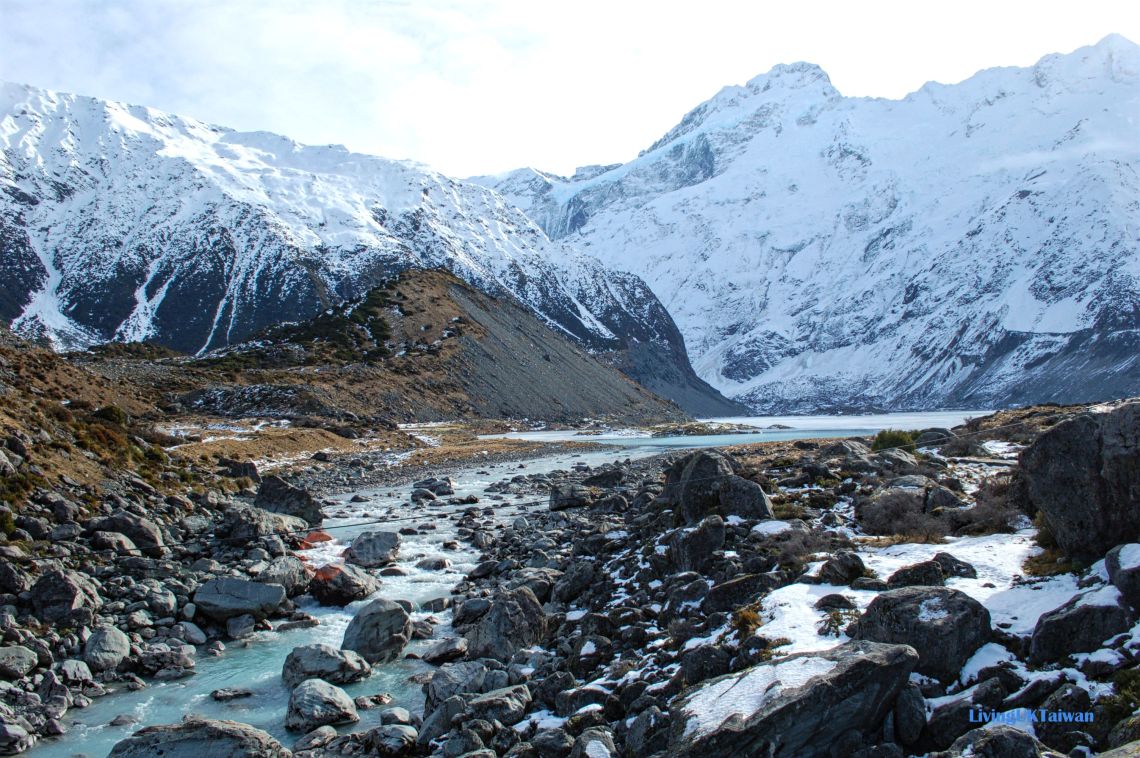
And here is the Mueller Glacier on the other side of the bridge, flowing out towards Hooker valley.
這是吊橋另外一邊的 Mueller Glacier 流向 Hooker Valley.

Overall we walked for over 10km that day and it was a very satisfying hike as I don’t often get a chance to hike in the snow. I fully recommend visiting Mount Cook if you like hiking, it makes a great day out for the whole family.
結果當天我們也走了超過10km,覺得很滿足,因為平時沒甚麼機會在雪地上遠足。有機會到庫克山區的話,很推薦花一點點時間去遠足,一家大少都適合。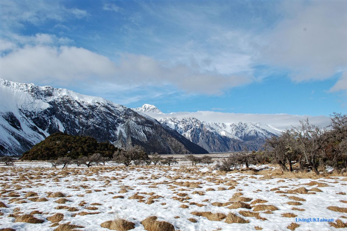
Wow so this is how Mount Cook looks in winter. Very nice! We went in summer and we loved tramping there too.
🙂
[…] New Zealand adventures Part 4 ~ hiking at Mount Cook 新西蘭旅遊篇之一 ~ 庫克山遠足 […]